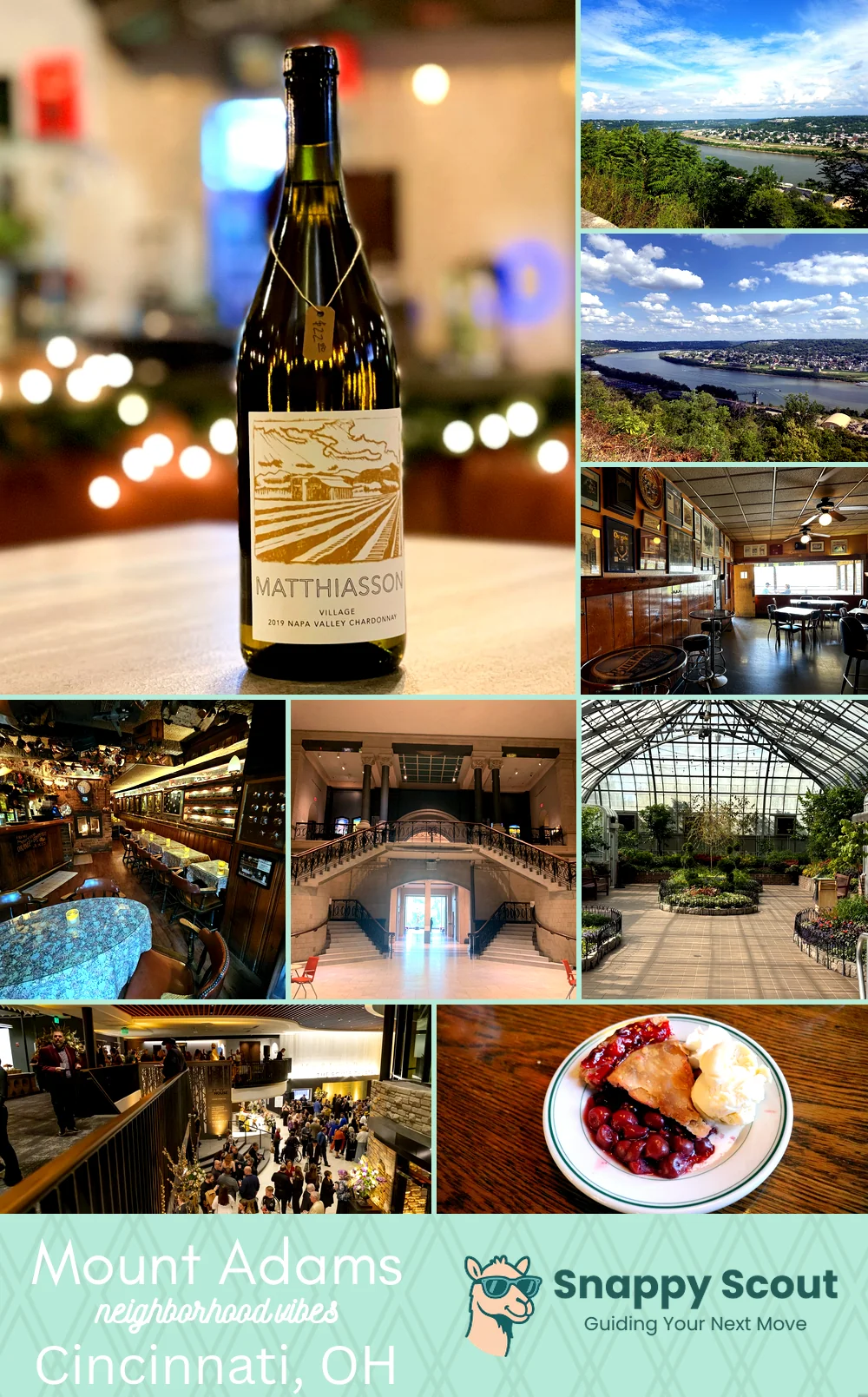
Mount Adams Neighborhood Overview
Skyline Sips, Holy Steps, Bar-Hop Chic
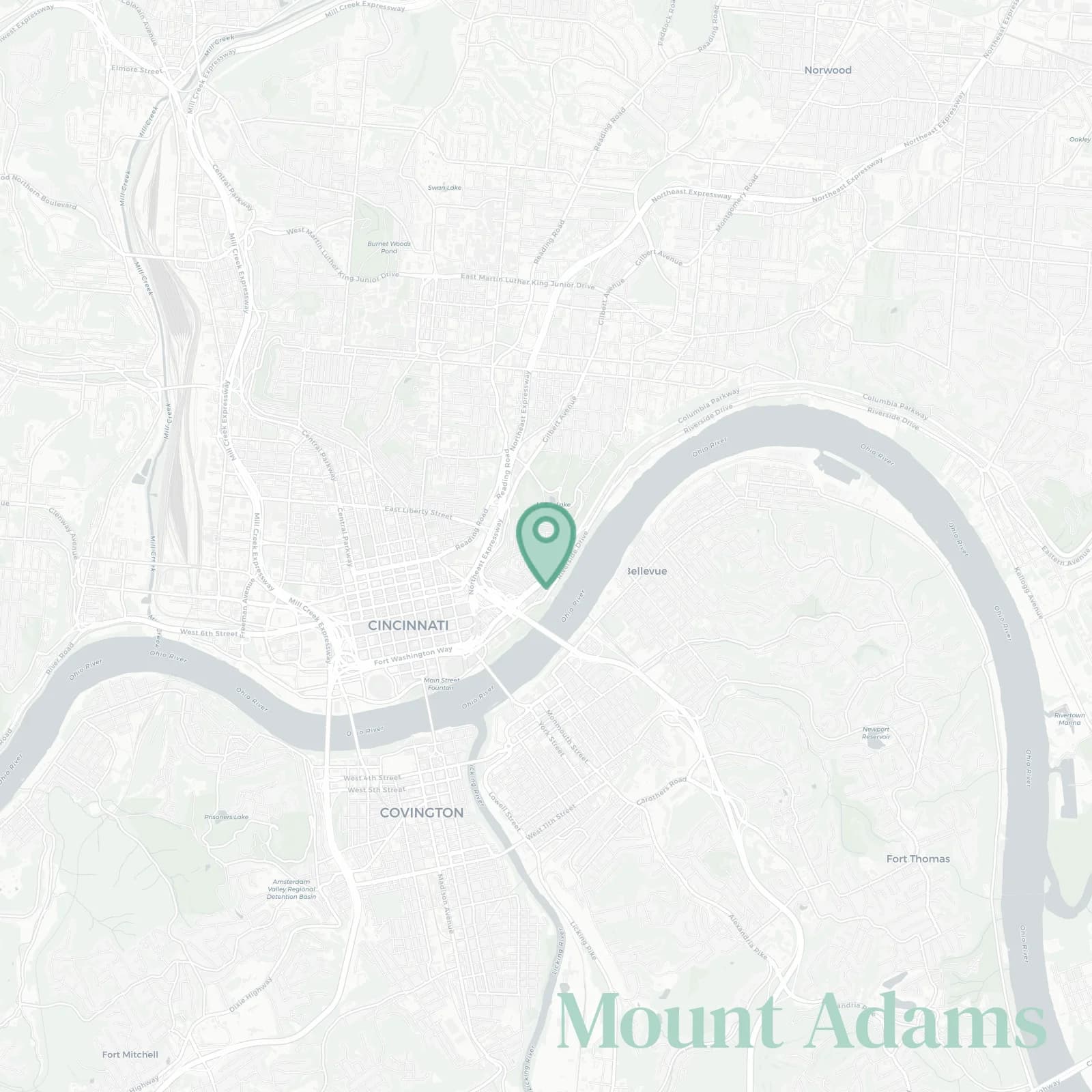
🧭Bordered by: Columbia Parkway and the Ohio River bluff to the south, I-471, Eggleston Avenue, and Pete Rose Way to the west, Eden Park Drive around Krohn Conservatory and Cincinnati Art Museum to the north, Gilbert Avenue, Elsinore Place, and Eden Park overlook to the east
📌Best known for: Good Friday steps, where people crawl up on their knees for penance, and skyline panoramas from every rooftop bar
👕You can spot a Mount Adams local by: calf muscles (we can not stress this enough, seriously, the hills are no joke), patio dominance, and rain or shine trivia at Pavilion on Thursdays
👍Locals live here because: mornings in Eden Park, nights on balconies watching fireworks from both stadiums without leaving home
👎The downside to Mount Adams is: parking hunger (street parking is a myth), epic hills that make delivery drivers weep, sirens echoing up from downtown at all hours, and weekend bridge traffic when tourists discover the view
✨The overall feel is: historic cliff village with swagger and bar crawls that double as cardio

sunset chasers, bar hoppers, unapologetic staircase conquerors with quads of steel