Rachael Riner profile picture
Rachael Riner
North Carolina Local Expert

Last Modified: January 20, 2026

Laurel Hill map

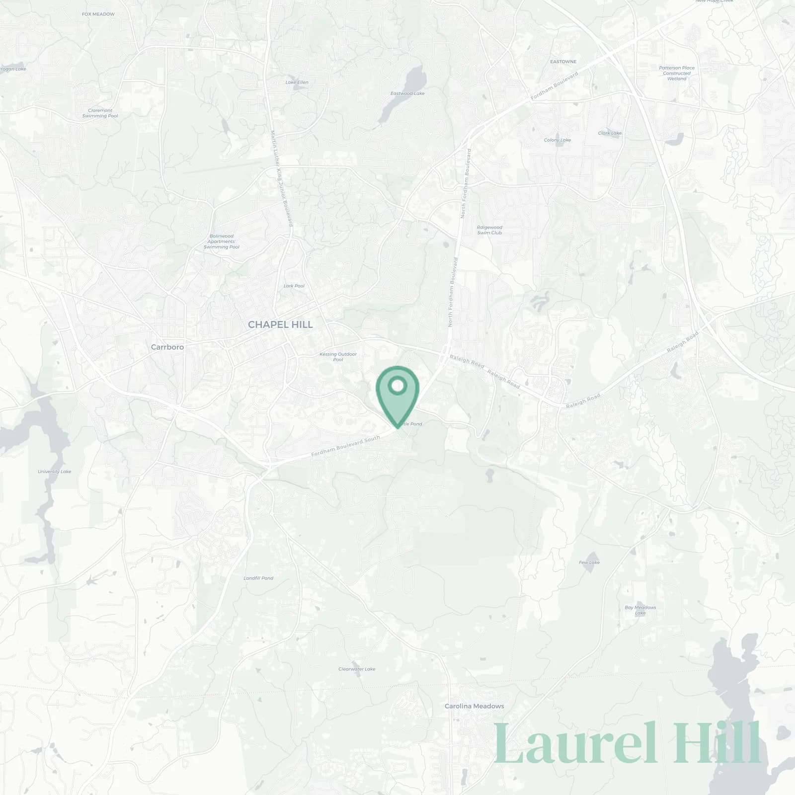
Laurel Hill Neighborhood Overview

Battle Park, Mid-Mods, 3 Subarus/Garage

🧭Geographically defined by: Raleigh Road and Country Club Road to the north, Fordham Boulevard to the west, Morgan Creek and the Morgan Creek Trail to the south, the North Carolina Botanical Garden, Old Mason Farm Road, and UNC Finley Golf Course to the east

📌Best known for: shady canopies, classic Hill homes, and sloping sidewalks

👕You can spot a Laurel Hill local by: mud-splattered Subarus, Tar Heel hoodies, Latin plant name flexes

👍Locals live here because: bluebird mornings, walkable woods, quick drives to campus

👎Don't say we didn't warn you about: sloped driveways that laugh at snow and parallel parking

The vibe around Laurel Hill is: leafy, scholarly, subtly sophisticated

fall foliage fanatics and hill-conquering stroller warriors

Laurel Hill neighborhood photo collage
Some of the Laurel Hill hotspots include: Cat's Cradle, Bolin Creek Trail, Carrboro Farmers' Market, University Place, and Chapel Hill Public Library.
Rachael Riner profile picture

Rachael Riner North Carolina Local Expert

At Snappy Scout, I combine lived experience with real neighborhood data to cut through the hype and help you make clearer decisions about where to move.

Snappy Scout logo

Moving to Laurel Hill - Make Sense Of Your Next Move

Whether you're new to Chapel Hill or deciding which part of the city fits you best, Snappy Scout cuts through the noise and shows you what living here is really like. If you're still finding your way, start with our Moving to Chapel Hill guide for the big-picture view — or compare Laurel Hill against other parts of the city in our Chapel Hill neighborhood guide.